- bhavya gada
- No Comments
Community engagement is essential for managing stormwater effectively, especially in Maryland, where regulations require public involvement in stormwater projects. Digital tools are transforming how residents participate, providing accessible ways to report issues, stay informed, and contribute to solutions. Here are six key tools making a difference:
- SeeClickFix: A mobile app for reporting stormwater issues like clogged drains with real-time updates and integration with local government systems.
- MyCoast: A platform for uploading photos of flooding, combined with weather and tidal data, helping communities and officials respond to flood risks.
- Nextdoor: A neighborhood-focused social network for sharing stormwater concerns, receiving updates, and connecting with local agencies.
- Facebook Community Groups: A widely-used platform for real-time issue reporting, event coordination, and sharing educational resources.
- Maryland iMap: A GIS platform offering interactive maps and stormwater infrastructure data for residents and officials.
- Pro Landscapes MD: A Maryland-based service provider offering drainage solutions and community education on stormwater management.
These tools empower residents to engage with local stormwater efforts, improving outcomes through better communication and collaboration. Whether through apps, social platforms, or professional services, Maryland communities have multiple ways to address stormwater challenges.
Kirkland Watershed Dashboard: An Online Tool to Engage Residents and Inspire Behavior Change
1. SeeClickFix

SeeClickFix is changing the way Maryland communities address stormwater problems by giving residents a direct line to local governments. This digital platform, available as a mobile app, allows users to report issues like clogged drains or flooding with just a few taps, making it easier than ever to tackle stormwater challenges.
Real-time Reporting and Feedback Capabilities
With SeeClickFix, residents can quickly report stormwater issues by submitting photos, detailed descriptions, and GPS-tagged locations. Each report is timestamped and updated in real time, ensuring swift communication.
For example, in 2023, the City of Baltimore managed over 12,000 stormwater service requests through the platform, leading to a 25% increase in resident-reported issues[5]. Similarly, in New Haven, Connecticut, 85% of reported blockages were resolved within 48 hours in June 2022, significantly reducing flooding incidents[5]. This instant exchange of information helps communities respond more efficiently.
Integration with Local Government Systems
The platform integrates seamlessly with municipal systems like work order and customer relationship management (CRM) tools. Once a report is submitted, it’s automatically routed to the relevant department – whether it’s public works or stormwater management. With additional integration into GIS and asset management systems, cities can identify patterns, track problem areas, and prioritize repairs where they’re needed most.
Accessibility and Ease of Use for Residents
SeeClickFix is available for both iOS and Android, boasting a 4.5-star rating on both platforms as of 2024. Its user-friendly interface guides residents through a simple process of reporting issues, using prompts and map-based tagging. The app supports multiple languages and even allows anonymous submissions, making it accessible to a wide range of users, including those less familiar with technology.
Support for Education and Awareness Campaigns
Beyond reporting, SeeClickFix helps educate residents about stormwater management. Municipalities can share updates, tips, and educational resources directly through the app, fostering a sense of community involvement. When residents see their concerns addressed, they’re more likely to participate in future efforts, like clean-up events or awareness campaigns.
As of 2024, SeeClickFix has processed over 10 million reports nationwide, helping municipalities cut response times for non-emergency public works issues by as much as 40%[5]. This tool not only improves efficiency but also strengthens the connection between residents and their local governments.
2. MyCoast
MyCoast is a platform that collects photos of flooding in Maryland and pairs them with real-time weather and tidal data to provide valuable insights into local flooding events [6]. Through a mobile app or web browser, residents can easily upload images of flooding or storm damage. This initiative is managed by the Maryland Department of Natural Resources (MDNR) [7].
Real-time Reporting and Data Integration
With MyCoast, users contribute by submitting photos of flooding events. These images are combined with up-to-the-minute weather and tidal data, creating a detailed record of flooding impacts in the area [6]. This streamlined process makes it easier for government agencies to access accurate, timely data, fostering better collaboration and response strategies.
Connecting Communities and Local Governments
The platform bridges the gap between community data and state stormwater management efforts [7]. The information gathered helps government agencies, business owners, and residents better understand the effects of flooding. This, in turn, encourages proactive measures to address and reduce localized flooding risks [6].
Promoting Education and Preparedness
MyCoast also plays a key role in raising awareness about flooding [6]. It focuses on reaching areas more vulnerable to flooding, enabling coastal leaders and community groups to use the data for smarter decisions about stormwater infrastructure and disaster preparedness. The insights gained through the program guide MDNR in expanding MyCoast across Maryland, ensuring that at-risk communities receive essential information and support [7].
3. Nextdoor
Nextdoor is a social networking platform designed to connect neighbors within specific geographic areas, making it an effective tool for engaging communities on stormwater issues. With more than 40 million active users across over 285,000 neighborhoods in the United States as of 2024, it provides a direct line of communication between residents and local agencies working on stormwater projects[5]. The platform’s ability to collect feedback fosters community-driven solutions for managing stormwater challenges.
Real-time Reporting and Feedback Capabilities
Nextdoor allows residents to quickly report stormwater-related issues, such as flooding, blocked drains, or excessive runoff, by posting updates directly to their neighborhood feed. These posts are visible to both neighbors and local officials, enabling a quick response to emerging problems[1][3]. This real-time feedback loop helps prevent minor issues from escalating into major challenges, which has proven especially valuable for communities in Maryland.
For example, during a heavy rainstorm in March 2024, Baltimore’s Department of Public Works used Nextdoor to crowdsource reports of clogged storm drains. In just 48 hours, they received over 1,500 reports, which allowed maintenance crews to act swiftly and reduce localized flooding across the city.
Integration with Local Government or Community Systems
More than 5,000 public agencies, including city governments and public works departments, have official Nextdoor accounts to communicate directly with residents. This integration simplifies the process of sharing updates on projects, gathering input through surveys, and keeping the community informed about planning efforts[2][3].
One standout feature is Nextdoor’s "Urgent Alert" tool, which allows agencies to send time-sensitive notifications, such as flood warnings or stormwater advisories, directly to affected residents. Many local governments now include Nextdoor as a key part of their public engagement strategies, particularly for environmental and infrastructure-related topics. These efforts have strengthened stormwater management programs across the country.
Accessibility and Ease of Use for Residents
Nextdoor is designed with user accessibility in mind, making it easy for people of all ages and technical abilities to participate. Its simple, intuitive interface works seamlessly on both web browsers and mobile devices, and the sign-up process is straightforward, even for those with minimal tech experience[3]. The platform’s neighborhood-based structure ensures that users see relevant local content without being overwhelmed by unrelated information.
Additionally, Nextdoor includes features to support users with disabilities and consistently receives high ratings for its user-friendly design[5].
Support for Education and Awareness Campaigns
Beyond connecting neighbors, Nextdoor serves as a valuable tool for education and outreach. Community leaders and environmental groups use the platform to share resources like infographics, videos, and event announcements to inform residents about stormwater issues and best practices[1][4]. A 2022 case study found that posts about local environmental initiatives, including stormwater management, achieved an average engagement rate of 18%, far exceeding the performance of traditional municipal email newsletters.
In September 2023, the City of Austin, Texas, used Nextdoor to promote workshops on green stormwater infrastructure. Their campaign reached over 120,000 residents, leading to a 27% increase in workshop attendance compared to previous years. The platform’s interactive features, like Q&A sessions, also make it easier to explain complex stormwater concepts and debunk common misconceptions[4].
4. Facebook Community Groups
Facebook Community Groups have become a go-to platform for engaging communities on stormwater issues. These groups provide a familiar and accessible space for residents to connect, voice concerns, and collaborate on local water management efforts. With Facebook’s widespread use across all age groups in the United States, these groups serve as a direct link between community members and local officials working on stormwater projects[1][3]. This creates an opportunity for quick responses and smooth collaboration between the government and the community.
Real-time Reporting and Feedback
One of the biggest advantages of Facebook Community Groups is the ability to report issues in real time. Residents can post updates, photos, or videos to flag stormwater problems as they happen[1]. Local officials and group administrators monitoring these posts can respond quickly, offering guidance or coordinating emergency responses when needed[1]. Facebook’s notification system ensures that urgent concerns are promptly seen by the right people, making it an essential tool for mobilizing the community during storms or infrastructure failures.
Bridging Community and Government Systems
Facebook Groups also work well alongside local government systems. Municipalities use these groups to share updates, post public meeting notices, and invite residents to events. This integration helps turn informal community feedback into actionable insights for government programs[1][3]. By combining the strengths of grassroots input with official processes, these groups make it easier for residents to contribute to stormwater solutions.
Easy Access for All Residents
Facebook’s user-friendly design makes it accessible for people of all ages[1][3]. Posting updates, commenting, and sharing media is straightforward, eliminating barriers that might exist with more complicated reporting systems. Groups can be customized as public or private, allowing communities to adjust privacy and moderation settings as needed.
The mobile app ensures that residents can stay informed and participate from any device, regardless of their technical skills[1][3]. This accessibility makes Facebook Groups a great complement to other digital tools, offering a familiar platform for community discussions.
Educating and Raising Awareness
Facebook Community Groups are also effective for spreading awareness about stormwater management. Local officials and experts share infographics, videos, and resources from the EPA to educate residents on stormwater impacts and best practices[1][4]. The EPA even provides ready-made social media graphics designed for community groups to boost awareness about stormwater issues[4].
EPA data shows that combining social media campaigns with traditional outreach can increase public awareness of stormwater issues by up to 40%[4]. Facebook Groups enhance these efforts through live Q&A sessions, regular tips, and promotions for workshops or volunteer events[2][4]. These interactive features make complex stormwater concepts easier to understand and encourage residents to take practical steps in addressing local challenges.
For example, local governments in Maryland have used Facebook Groups to gather feedback on green infrastructure projects and organize volunteer events like rain garden installations. These efforts have led to higher community participation and better project outcomes[2]. By turning passive information sharing into active engagement, Facebook Groups are helping communities take meaningful steps toward environmental stewardship.
sbb-itb-843f8be
5. Maryland iMap
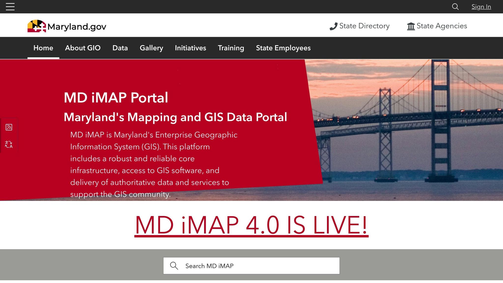
Maryland iMap serves as Maryland’s enterprise GIS platform, offering advanced mapping tools tailored for stormwater management needs [8]. This platform provides residents and officials with detailed geographic data and interactive maps, making stormwater management more visual and approachable compared to traditional reporting methods. It bridges the gap between conventional reporting and modern GIS technology, enabling better community engagement.
Integration with Local Government Systems
Maryland iMap acts as a centralized platform, connecting various county and municipal systems across the state. It provides access to Maryland’s GIS Data Catalog, which includes datasets like the MDOT SHA NPDES Stormwater Management Facilities (SWMFAC). This dataset contains 15,957 records, detailing ponds, wetlands, and infiltration systems that manage drainage from state highway administration facilities. Such data offers communities a clear view of existing stormwater infrastructure [11].
The platform is built using ArcGIS Hub technology, ensuring compatibility with professional GIS software used by government agencies [8]. This setup allows local departments to share verified data directly with the public, creating a stronger connection between officials and community members. By combining authoritative datasets with user-friendly tools, Maryland iMap helps local governments and residents work together more effectively.
Accessibility and Ease of Use for Residents
One of Maryland iMap’s most practical features is its ability to make complex data accessible for everyday users. For example, Montgomery County provides an interactive map where residents can search by address to locate nearby stormwater facilities [9]. The map uses colored dots to represent different types of facilities, and clicking on a dot reveals detailed information about that specific location.
This address-based search, paired with color-coded markers, helps homeowners quickly find stormwater facilities near them and understand their role in the system. Washington County further enhances accessibility by offering open data in multiple formats, such as DWGs (AutoCAD), Shapefiles, and Geodatabases. This ensures that both technical professionals and general users can access the information in a format that suits their needs [10].
Support for Education and Awareness Campaigns
Maryland iMap also plays a vital role in educating the public and raising awareness about stormwater management. By making complex concepts more tangible, it encourages community involvement. For instance, Montgomery County’s Stormwater Maintenance and Inspection Program uses the mapping system to help residents understand their responsibilities for maintaining private stormwater facilities [9]. By visually displaying the location and type of facilities, the maps turn regulatory guidelines into actionable steps for property owners, fostering a more informed and engaged community.
6. Pro Landscapes MD
Pro Landscapes MD delivers a mix of expert stormwater management services and community-focused initiatives throughout central Maryland and Washington, DC. Their approach bridges the gap between digital tools and on-the-ground solutions, offering practical support while engaging directly with residents. By combining technology with hands-on expertise, they create a seamless connection between community input and effective action.
Real-time Reporting and Feedback
Pro Landscapes MD makes it simple for residents to report drainage or flooding issues through their website and customer service lines. This real-time communication ensures quick identification and resolution of problems like erosion, flooding, or malfunctioning drainage systems.
To keep residents informed, the company uses digital tools like online updates and feedback mechanisms. These features promote transparency and encourage ongoing community involvement, helping improve the overall quality of their services.
Collaboration with Local Governments and Communities
Working closely with local governments and community organizations, Pro Landscapes MD ensures their stormwater solutions align with local regulations and public infrastructure needs. Their services range from drainage installations and French drains to dry riverbeds, grading, and land leveling – each tailored to integrate smoothly with existing systems.
This collaborative approach simplifies permitting processes, supports regional stormwater initiatives, and contributes to broader environmental goals. By customizing solutions based on factors like property size, soil type, and local rules, Pro Landscapes MD ensures their work is both effective and well-suited to the area.
Making Services Accessible to Residents
Accessibility is a priority for Pro Landscapes MD. They offer free consultations, clear service descriptions, and responsive customer support. Their user-friendly website lets residents easily request services, report issues, and find helpful resources. Covering a broad area – from Annapolis to Wheaton – they bring their expertise to a wide range of communities across central Maryland.
Promoting Education and Awareness
Pro Landscapes MD goes beyond providing services by actively educating the community. Through their website, social media, and local events, they share tips on sustainable landscaping, proper drainage, and eco-friendly practices. Topics like rain gardens, permeable pavers, and native plants are highlighted to help residents understand how their choices affect water quality and stormwater runoff.
The company also supports community-driven initiatives by contributing expertise and resources. Their involvement encourages residents to take an active role in improving stormwater management and protecting the environment. Additionally, they install green infrastructure – such as environmental pavers and native plantings – that reduces runoff and helps recharge groundwater, aligning with sustainable practices in stormwater management.
Tool Comparison Chart
Selecting the right community engagement tool for stormwater projects hinges on understanding your community’s unique needs, audience, and local requirements. Below is a detailed comparison of key platforms, highlighting their features, accessibility, and integration options to help guide your decision.
| Tool | Primary Function | Cost | Geographic Focus | Key Strengths | Integration Capabilities | Best For |
|---|---|---|---|---|---|---|
| SeeClickFix | Issue reporting and tracking | Free for residents; paid plans for municipalities | Nationwide | Real-time problem reporting, photo documentation, status updates | Integrates with municipal systems and GIS mapping | Quick issue identification and resolution |
| MyCoast | Coastal monitoring and reporting | Free | Coastal regions nationwide | Photo-based reporting, scientific data collection, flooding documentation | NOAA integration and research databases | Coastal communities and flood monitoring |
| Nextdoor | Neighborhood social networking | Free | Nationwide | Hyperlocal focus, verified residents, high engagement rates | Basic social integrations | Building neighborhood awareness |
| Facebook Community Groups | Social media engagement | Free | Worldwide | Wide user base, multimedia sharing, event coordination | Integrated with other Facebook tools | Broad community outreach and education |
| Maryland iMap | Geographic data visualization | Free | Maryland statewide | Detailed mapping, watershed information, and regulatory compliance data | State database integration and GIS compatibility | Planning and regulatory compliance |
| Pro Landscapes MD | Professional stormwater services | Custom quotes | Central Maryland and Washington, DC | Professional expertise paired with community education | Seamlessly integrates with local government systems | Professional implementation and community education |
This chart simplifies the decision-making process by outlining the core features of each tool, helping you align your community’s priorities with the right platform. For example, platforms like Facebook Community Groups and Nextdoor are excellent for fostering broad community engagement and awareness, while Maryland iMap provides detailed geographic and regulatory insights tailored to stormwater planning.
For Maryland-specific projects, tools that align with municipal systems and adhere to state stormwater compliance guidelines offer the most practical solutions. Digital platforms such as SeeClickFix are ideal for urban areas with recurring drainage issues, while MyCoast is perfect for coastal communities managing flooding concerns. On the other hand, Pro Landscapes MD combines professional expertise with educational outreach, making it a standout choice for both implementation and community involvement.
Whether you’re looking for free, user-friendly tools or specialized services, this comparison ensures you can find the right fit for your stormwater project. From hyperlocal social networking to professional, hands-on solutions, there’s an option to meet every community’s needs.
Conclusion
Managing stormwater effectively isn’t just about technical know-how – it’s about bringing communities together and equipping them with the right tools to make meaningful contributions. The platforms and services mentioned in this guide highlight how technology can connect residents with environmental efforts in a practical and impactful way.
Digital tools like SeeClickFix, MyCoast, and social media platforms make it easier for residents to report issues and get real-time updates, ensuring swift responses to local problems[1]. On top of that, specialized platforms like Maryland iMap enhance the precision and success of stormwater projects. According to the EPA, public education and outreach are essential components of municipal stormwater permit programs, emphasizing the critical role of community involvement in long-term success[4].
Local providers, such as Pro Landscapes MD, show how community feedback can lead to practical solutions. Their services, which include French drains, rain gardens, and eco-friendly landscaping, transform local input into sustainable stormwater management practices[2].
Combining digital tools with in-person strategies creates a stronger connection between communities and stormwater initiatives. Whether through social media, newsletters, or public meetings, keeping residents informed fosters transparency and trust – key ingredients for lasting success.
As stormwater challenges grow across Maryland and beyond, the partnership between advanced technology and local expertise offers a promising way forward. This collaborative approach not only tackles immediate drainage issues but also builds a foundation for sustainable, resilient solutions that safeguard both people and the environment for generations to come.
FAQs
What are the best ways for residents to use digital tools like SeeClickFix to report stormwater issues in their community?
Residents now have access to digital platforms like SeeClickFix to report stormwater problems in their neighborhoods with ease. Using a smartphone or computer, they can submit detailed reports, complete with photos and descriptions, ensuring their concerns are clearly communicated.
These submissions are automatically routed to the relevant local departments, helping officials address issues more efficiently. Plus, residents can monitor the progress of their reports, promoting transparency and encouraging active participation in managing stormwater challenges. This process simplifies communication and contributes to cleaner, safer communities for all.
How does MyCoast help Maryland communities prepare for and respond to flooding?
MyCoast gives Maryland residents a powerful tool to tackle flooding challenges. By allowing individuals to capture and share photos of flood events as they happen, the platform provides real-time data that local officials can use to track flood impacts, refine planning efforts, and highlight flood risks within the community.
Through this collaborative approach, MyCoast strengthens community involvement and contributes to smarter stormwater management and flood prevention strategies across Maryland.
How can platforms like Nextdoor and Facebook Groups help residents and local governments collaborate on stormwater management?
Platforms such as Nextdoor and Facebook Groups have become valuable tools for connecting residents and local governments when it comes to managing stormwater. These platforms let community members share real-time updates, report problems like blocked storm drains, and access helpful resources about preventing floods and managing water effectively.
By promoting open communication, these tools boost awareness, inspire community participation, and allow for faster responses to stormwater issues. This kind of collaboration plays a key role in improving flood prevention and ensuring smarter water management in local areas.





Chat with Us