









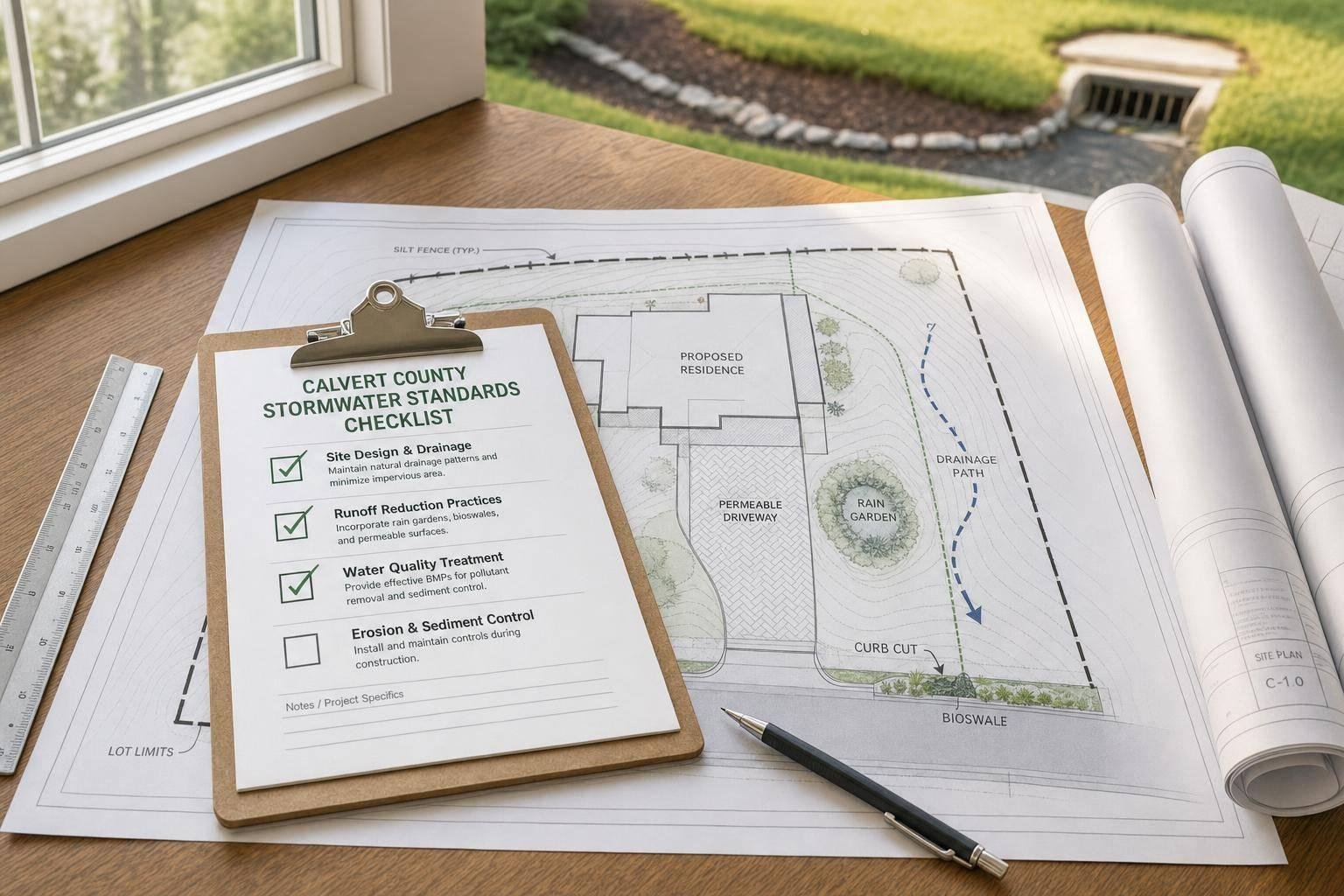
- bhavya gada
- No Comments
If your project in Calvert County disturbs more than 5,000 square feet of land, stormwater review will usually apply. And if it involves more than 100 cubic yards of cut or fill, you will usually need plans from a licensed design professional.
Here’s the short version: before I design or build a patio, driveway, retaining wall, drain, or grading fix, I need to check the lot records, map how water moves, measure disturbance, screen for permit triggers, pick the right runoff controls, and get the site ready for final inspection and long-term upkeep.
What I’d check first:
- Lot records: plat, deed, zoning, easements, floodplain, and Critical Area limits
- Key thresholds: 5,000 sq. ft. disturbed and 100 cu. yd. of cut/fill
- Drainage basics: water should move away from the house, not onto a neighbor’s lot
- Slope basics: about 2% fall away from foundations, 1%–5% for lawns, and 1%–2% for patios and driveways
- Plan package: plot plan or sealed plan, drainage map, grading plan, sizing calculations, and maintenance papers
- Closeout: final field check, as-built certification, photos, and a maintenance log
A few points can change the whole job. For example, a lot in the Chesapeake Bay Critical Area may face lot coverage limits, and even a small hardscape addition can affect what I’m allowed to build. In the same way, runoff that leaves the lot the wrong way can stop approval fast.
So if I want to avoid redraws, permit delays, or failed inspection, I start with the site facts first and the design second.
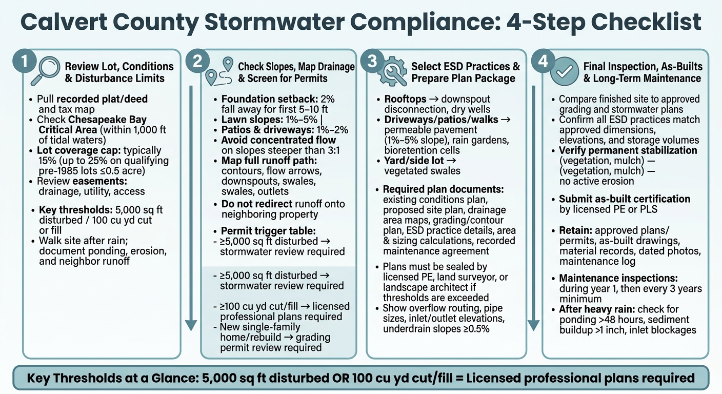
Calvert County Stormwater Compliance: 4-Step Checklist
Step 1: Review The Lot, Existing Conditions, And Disturbance Limits
Start here: check the lot records and site limits before you get into design. This early review helps you see whether the job may move through a simpler path or set off a more detailed stormwater and grading review.
Confirm Parcel Data, Zoning, Easements, And Protected Areas
Pull the recorded plat or deed and the tax map first. You need the exact lot size in square feet or acres, the zoning classification, and any overlay districts. Those details shape what you can build and how much land you may disturb.
One overlay to check closely is the Chesapeake Bay Critical Area. It can limit both lot coverage and grading. It includes all land within 1,000 feet of tidal waters or tidal wetlands[10][11][16]. Lot coverage caps may apply, often 15% of the lot, or up to 25% on some pre-December 1, 1985 lots of 0.5 acre or less[12][17].
Review the plat with care for recorded easements, including drainage easements, utility easements, and access easements. These areas often contain stormwater features already in place, and grading or building inside them is often limited or not allowed[1][13]. You should also flag any floodplains, forest retention areas, natural resource protection areas, or Critical Area buffers shown in county records. These can limit where grading and new impervious surfaces may go[15].
Once you know the lot limits, you can make a rough call on how much ground the work will disturb.
Estimate Land Disturbance, Cut And Fill, And Lot Coverage
Sketch a rough limit of disturbance (LOD). This is the full ground area that will be exposed or changed during construction, including staging areas and access routes. Calvert County permit checklists say the LOD must be clearly shown and labeled on plan drawings[3][4].
Then compare your rough LOD and cut/fill totals against Calvert County’s review thresholds.
Next, total up all new impervious area from each proposed feature, such as a patio, walkway, driveway, or other hardscape. Compare that number against the lot coverage cap that applies to the parcel. On Critical Area lots that are already close to the limit, even a small addition can force plan changes or mitigation[12][17].
After you’ve estimated disturbance limits, turn to the drainage issues that already exist on the property.
Document Existing Problem Areas Before Any Design Changes
Walk the site after rain and write down what you find. Look for ponding spots that hold water for more than 24–48 hours, soggy lawn areas, erosion at downspout discharge points, and runoff that crosses into a neighboring yard[1][4][14]. Mark each spot on the plan, and date your photos so inspectors can confirm the conditions were already there before work started.
sbb-itb-843f8be
Step 2: Check Slopes, Map Drainage Paths, And Answer Permit Questions
Use the lot limits, disturbance sketch, and problem areas from Step 1 to make sure the site moves water safely before design work goes any further.
Measure Existing And Proposed Slopes For Positive Drainage
Start with the basics. Use a 2% fall away from foundations for the first 5–10 feet, keep lawns between 1% and 5%, and set patios and driveways at 1% to 2% so water drains instead of sitting in place.[1][20]
Steeper lots need extra care. Try not to send concentrated flow over slopes steeper than about 3:1 (horizontal to vertical). That kind of setup can chew up soil fast. A better move is to break drainage into shorter, flatter sections or use vegetated swales and level spreaders to slow flow and limit erosion.[1][22]
On the grading plan, show these slope changes clearly. Add slope labels and cross-sections at grade breaks so reviewers can check drainage and erosion control without guessing.[1]
Map Roof, Yard, Patio, And Driveway Runoff Paths
Your drainage map should show the full path water takes across the lot. That includes:
- Contours and spot elevations
- Flow arrows for roofs, yards, patios, and driveways
- Downspout locations and discharge points
- Swale alignments and slopes
- Low points, yard drains, and inlets
- The final outlet where runoff leaves the lot [19][1]
Water should not be redirected onto neighboring property unless a recorded drainage easement allows it.[1][8] If the plan changes existing drainage patterns, the map needs to show that runoff either stays on-site or reaches a public storm system through an established, permitted path.
Maryland’s ESD framework pushes this one step further. It favors keeping roof, driveway, and patio runoff spread out on-site first through rooftop disconnection to vegetated areas, sheet flow across lawns, or small infiltration practices before anything is sent off the lot.[1][22][23]
This runoff map is what permit reviewers will lean on when they screen the project and check the stormwater approach.
Determine Whether Grading Permits And Stormwater Plan Approval Are Required
Once slopes and runoff paths are mapped, check whether the project hits Calvert County review thresholds.[10][21][18][23][11][1]
| Screening Question | Threshold That Triggers Review |
|---|---|
| Total land area disturbed? | 5,000 sq ft or more |
| Total cut-and-fill volume? | 100 cubic yards or more |
| New single-family home or rebuild: grading permit review required | Yes |
| Impervious cover ≤ 15% of lot, disturbance < 30,000 sq ft, no contiguous development, and not in a special concern area? | Yes = may qualify for a Standard Single Lot Residential Stormwater Plan |
If the project goes past either threshold, submit a plan prepared by a licensed professional engineer, land surveyor, or landscape architect before any grading or building permit is issued.[2][5][8]
Step 3: Select Stormwater Practices And Prepare The Required Plan Package
Choose ESD Practices That Fit The Lot And Project Scope
Once you’ve mapped slopes and drainage paths, the next job is simple in theory: match each runoff source to one ESD practice.
That means you’re not picking practices at random. You’re tying each roof, paved area, or yard drainage path to the stormwater method that fits the lot and the project.
- Rooftops: Downspout disconnection and dry wells are commonly used for rooftop runoff from defined drainage areas. Each downspout should be sized to the roof area that drains to it. Dry wells also need to meet setback rules for foundations, septic systems, and potable water wells.[3][29][24]
- Driveways, patios, and walks: Permeable pavements tend to work best on slopes of about 1% to 5%, as long as the subgrade soils can infiltrate without causing instability. For smaller impervious areas, like short driveways, patios, and small roof sections, rain gardens or small bioretention cells are often a better fit. Use them for smaller drainage areas and keep ponding depth within the approved limit.[6][24][29]
- Yard and side lot drainage: Vegetated swales fit shallow sheet flow along driveway edges, side yards, and property lines.[27]
For each practice, show the runoff source, the drainage area, and the required versus provided ESD volume.[6][24][29]
After that, pull together the records that show the design meets storage and drainage rules.
Prepare Plans, Maps, Calculations, And Legal Documents
A complete submittal needs the full plan package below. In Calvert County, if the project disturbs 5,000 square feet or more or includes more than 100 cubic yards of cut and fill, the plans must be prepared and sealed by a licensed professional engineer, land surveyor, or landscape architect.[2]
| Document | What It Must Show |
|---|---|
| Existing conditions plan | Property boundaries, existing structures, driveways, patios, vegetation, topography, easements, streams, wetlands, critical areas, and existing stormwater facilities |
| Proposed site plan | New structures, additions, driveways, patios, decks, retaining walls, proposed grading, and clearly labeled limits of disturbance |
| Drainage area maps by downspout, driveway section, and practice | Contributing areas to each downspout, driveway section, and ESD practice, with impervious and pervious areas and drainage area sizes |
| Grading and contour plan | Existing and proposed contour lines, spot elevations, and flow arrows showing drainage to ESD practices and overflow paths |
| ESD practice details | Standard or site-specific details for rain gardens, small bioretention cells, dry wells, permeable pavements, swales, and other devices, with dimensions and material callouts |
| Area and sizing calculations | Existing, proposed, net impervious area, and required versus provided ESD volume |
| Recorded maintenance agreement | Owner responsibilities, county access rights, and recorded stormwater maintenance terms |
Plan sheets should also include a maintenance responsibility note. That way, the duty is clear during construction and in later inspections.[28][22]
Review Construction Notes And Material Specifications Before Approval
Before approval, make sure the plans show the field details that matter most: overflow routing, pipe sizes, inlet and outlet elevations, filter media specs, and stabilization details.[24][22]
Each ESD practice needs a clear overflow path. Show weir elevations, overflow pipe sizes, or spillway locations, and trace the discharge point to a stabilized outfall or downstream facility.[24] Underdrain slopes should be shown at about 0.5% or greater so the system drains as intended.[26][24]
Rain garden and small bioretention details should point to the Maryland Stormwater Design Manual standards for filter soil mixes and stone gradations.[26][24] At concentrated discharge points, include outlet protection details such as riprap pad dimensions and stone size.[7][24] Stabilization notes should also cover temporary and permanent seeding, mulching, and matting for disturbed areas.[7][24]
If construction changes come up, they should be approved by the design professional and, when required, Calvert County staff before work moves ahead.[28][22] In plain terms: don’t let field changes drift away from the approved drawings. If the installed work doesn’t match the plan, final inspection and as-builts can turn into a mess.
Step 4: Final Inspection, As-Builts, And Long-Term Maintenance
Run A Final Field Check Before Requesting Inspection
Once construction is done, shift from plan review to a field check.
Before you ask for county inspection, compare the finished site against the approved grading and stormwater plans. Calvert County requires ESD and nonstructural practices to be inspected after final grading and permanent stabilization and before use and occupancy approval.[1]
Look at each installed practice closely – bioretention, rain gardens, infiltration areas, swales, ponds, berms, and other structural devices. Make sure the location, dimensions, elevations, depths, side slopes, and storage volume match the approved plans.[30][22][9] Also confirm that roofs, driveways, and yard areas drain to the intended practice or discharge point, with no stray ponding near foundations or property lines.[22][6]
Check disturbed areas too. They should be stabilized with permanent vegetation, mulch, or other approved measures, and there should be no active erosion, rills, or gullies on slopes, embankments, or outfalls.[22][31] Review the paperwork at the same time. Confirm that review and inspection forms (R&I forms), grading permit conditions, stormwater devices, easements, and restrictive covenants are all in place, and that safe access plus any required fences or safety devices have been installed.[3][4][10][31]
Keep As-Built Records And A Maintenance Log
After the field check is clean, document the installed system for county closeout.
Calvert County requires an as-built plan certification prepared by a professional engineer or professional land surveyor licensed in Maryland.[1][22][32] The as-built submittal should include drawings that show approved design versus field conditions, along with the Notice of Construction Completion (NOCC), a narrative report, construction inspection reports for all required MDE intervals, and updated volume and routing calculations.[30]
Keep a project file with records like these:
| Record Type | What To Retain |
|---|---|
| Approved plans and permits | Original grading and stormwater plans, permit documents, signed R&I forms, Declaration of Restrictive Covenants (DoRC), NOCC |
| As-built documentation | Certified drawings, field survey notes, data tables comparing design vs. constructed conditions, approved plan revisions |
| Material records | Invoices, delivery tickets, filter media specifications, soil test reports, warranties |
| Photo documentation | Dated photos at project completion and after major storm events |
| Maintenance log | Inspection dates, observed conditions, sediment buildup, vegetation condition, and repairs made |
Good recordkeeping matters here. If something drains the wrong way six months later, or a planter bed starts holding water too long, this file gives you a clean trail back to what was built and what changed.
Maryland regulations require preventive maintenance inspections during the first year of operation and at least once every three years after that.[33] After heavy rain, check for ponding that lasts more than 48 hours; that usually points to media maintenance or replacement.[22][6] Remove sediment when buildup reaches about 1 inch across the bed surface, clean inlets and pretreatment areas, refresh mulch, and replace dead or invasive plantings with approved native species.[22][6][25]
Conclusion: The Core Compliance Points To Review On Every Project
Every project in Calvert County follows the same basic path: review the lot first, make sure slopes and drainage paths match the approved plan, spot permit triggers before design begins, choose ESD practices that fit the site, submit a complete plan package, and finish with final inspection and long-term maintenance.
Final approval is not the end of the owner’s duty. Recorded easements, restrictive covenants, and maintenance agreements keep the owner responsible for upkeep in perpetuity.[6][10] It helps to treat installed ESD practices like permanent site infrastructure. Set aside money for periodic maintenance, document each inspection, and talk with a qualified professional before making site changes that could affect drainage or impervious coverage.
FAQs
Does my project need stormwater review?
Whether you need a permit comes down to your project’s size, location, and how much land it disturbs.
In most cases, a permit is required if the project disturbs 1 acre or more.
That said, smaller projects can still need review. This often applies if the work:
- disturbs more than 5,000 square feet
- moves over 100 cubic yards of soil
- affects floodplains, wetlands, or watercourses
- changes an existing stormwater management facility
The safest move is to check with your county office about local rules.
What counts toward lot disturbance and cut or fill?
In Calvert County, lot disturbance means any part of the land affected by construction. That includes borrow areas, fill sites, exposed soil, stockpiles, and any spot where vegetation has been cleared.
Cut and fill refers to the total amount of material removed from the site or brought in for grading. And the numbers matter: permit rules may kick in at 5,000 square feet of disturbance or 100 cubic yards of excavation. That’s why accurate documentation is so important.
What happens if runoff is redirected onto a neighbor’s property?
Redirecting runoff onto a neighbor’s property is usually not allowed. In Maryland, stormwater rules aim to keep natural drainage patterns in place and reduce the risk of flooding.
That means stormwater should be handled where it starts. Common fixes include grading, rain gardens, and swales that guide water toward approved drainage points or waterways, not onto nearby property.
If runoff is handled the wrong way, it can lead to notices of violation.
Chat with Us